1. Product Overview
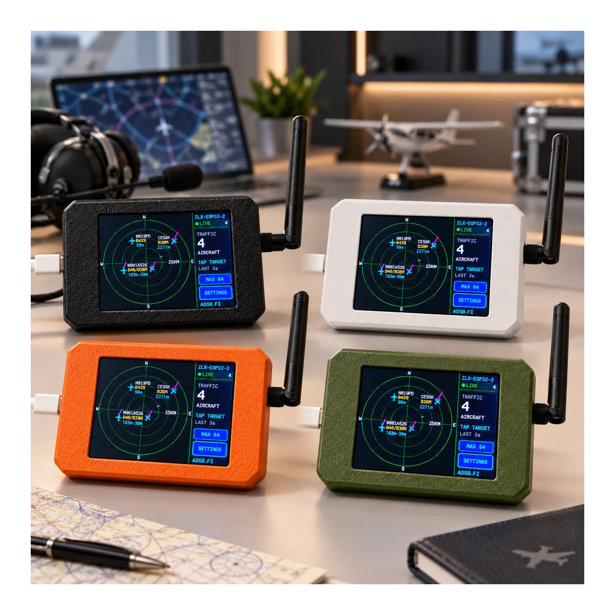
Plane Radar is a compact desktop flight-tracking display built around a C5 development board. It connects to Wi-Fi and retrieves aircraft information from supported online ADS-B data services, then displays nearby aircraft on a radar-style touchscreen interface.
2. Package Contents
- 1 × C5 development board with 2.4 GHz / 5 GHz dual-band Wi-Fi support
- 1 × 3D printed enclosure, pre-installed on the device
- 1 × Touchscreen stylus
- 1 × USB data cable
The product is supplied as an assembled unit with the 3D printed enclosure already installed.
3. Main Features
- 2.8" Touchscreen: Radar view and settings are operated directly from the color touchscreen.
- Dual-Band Wi-Fi: Supports compatible 2.4 GHz and 5 GHz Wi-Fi networks.
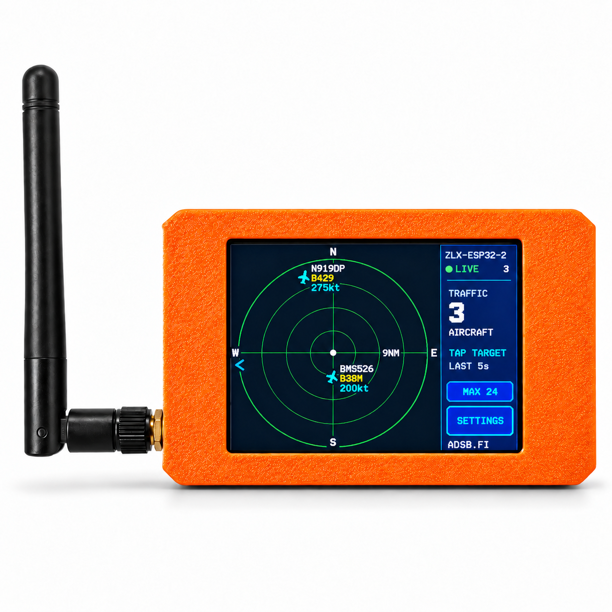
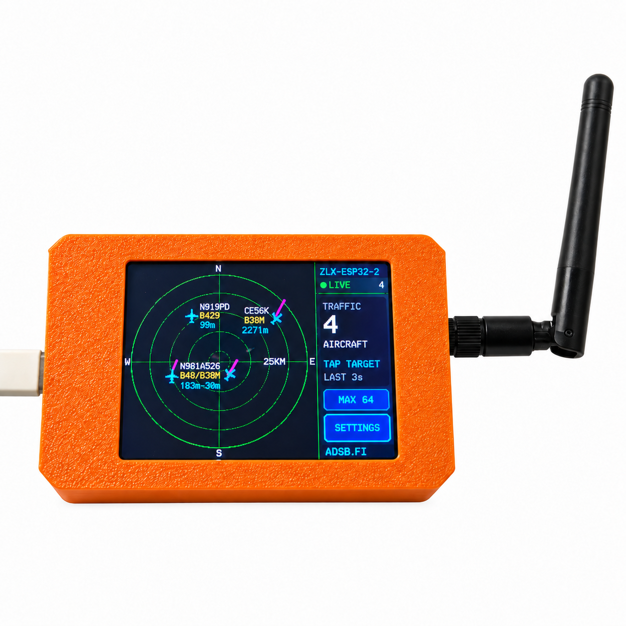
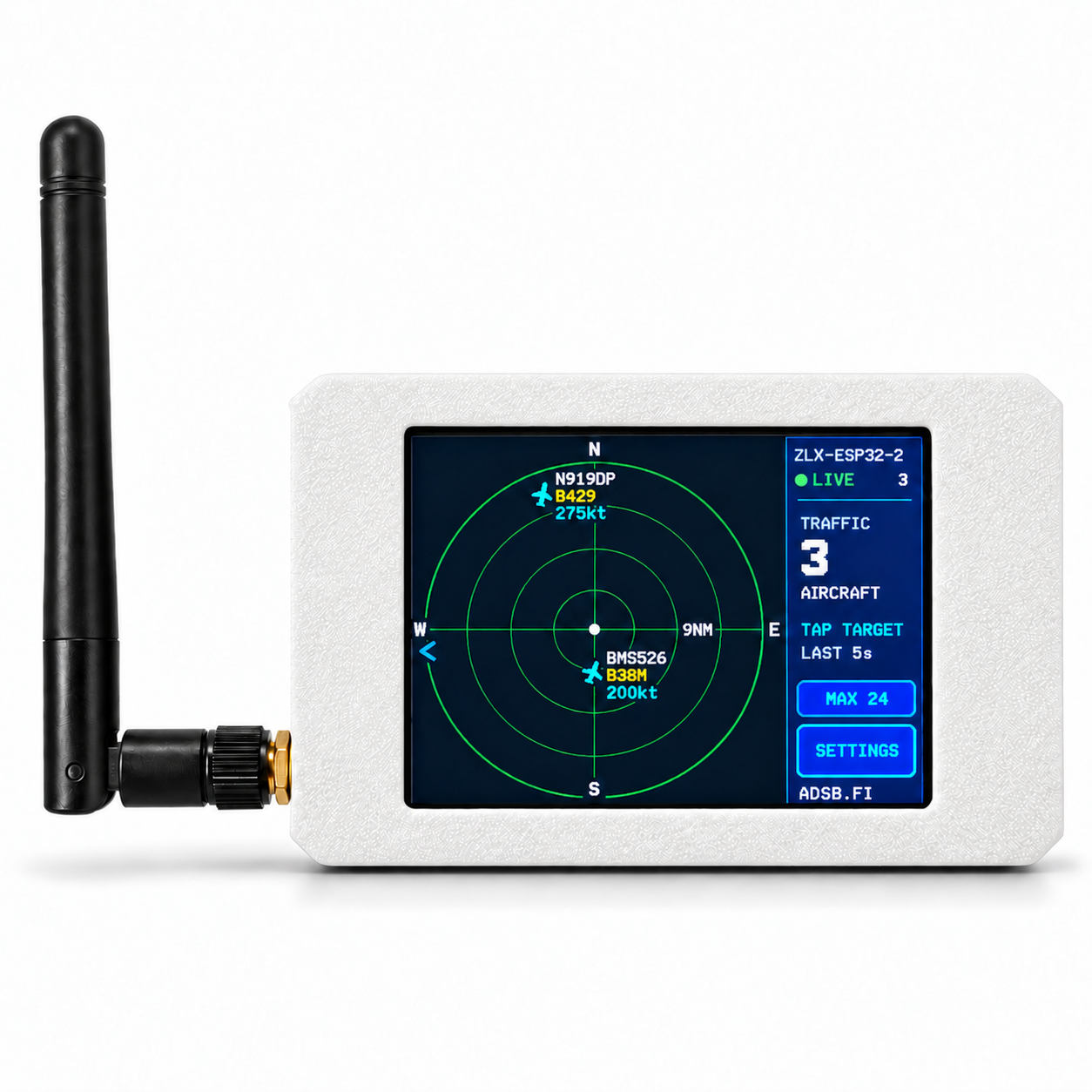
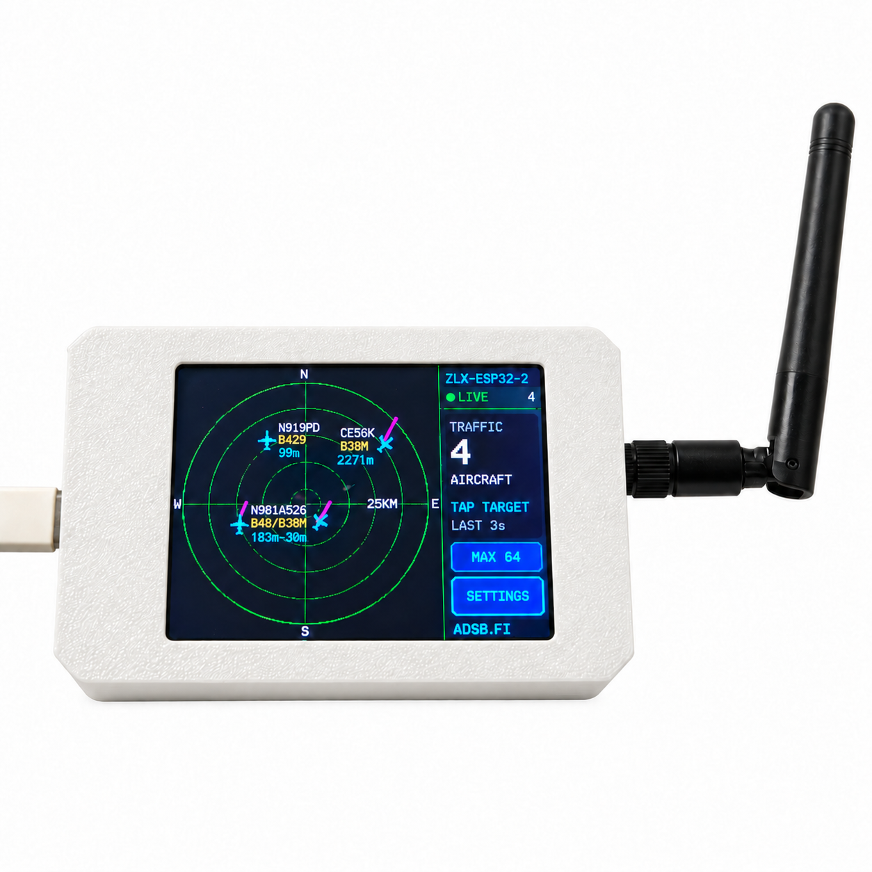
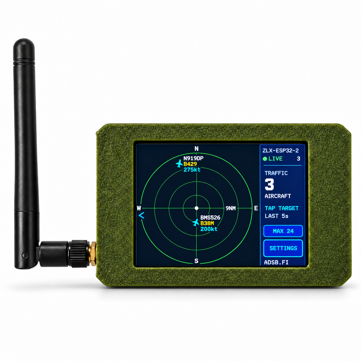
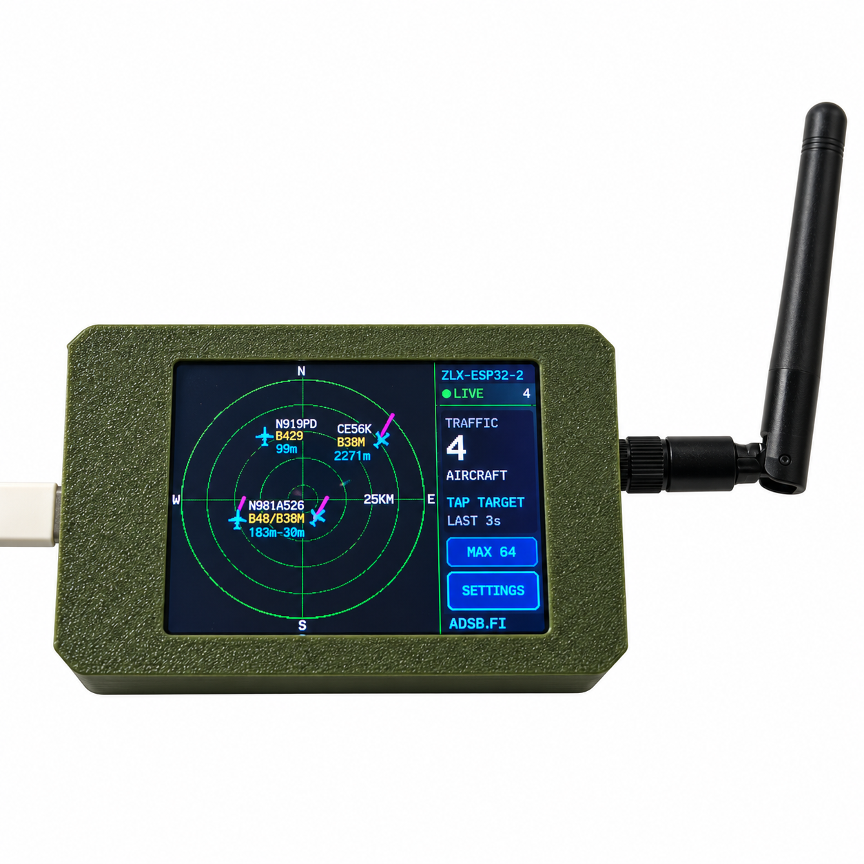
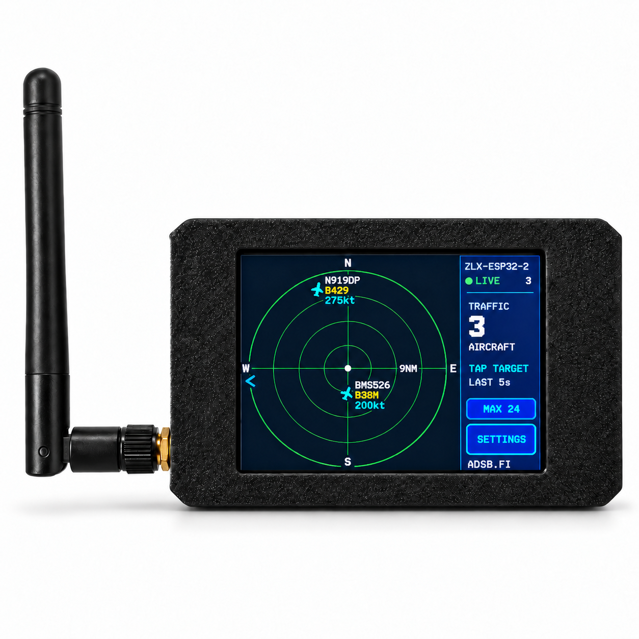
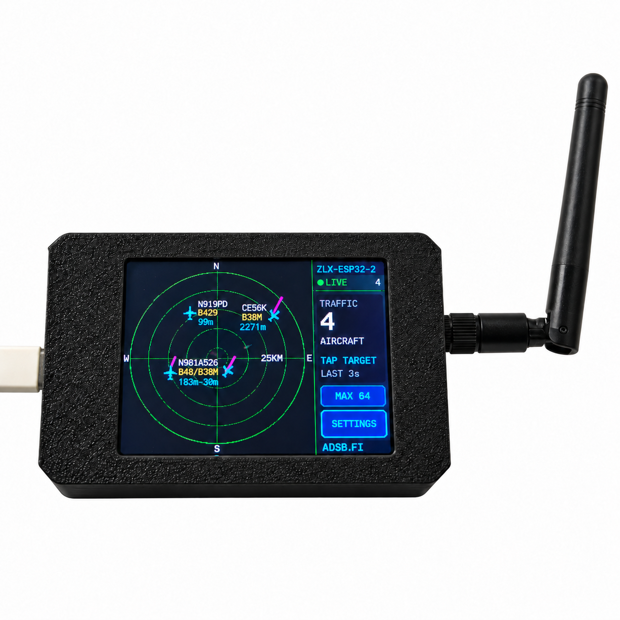
- Radar-Style Aircraft View: Shows nearby aircraft with direction, distance and available flight information.
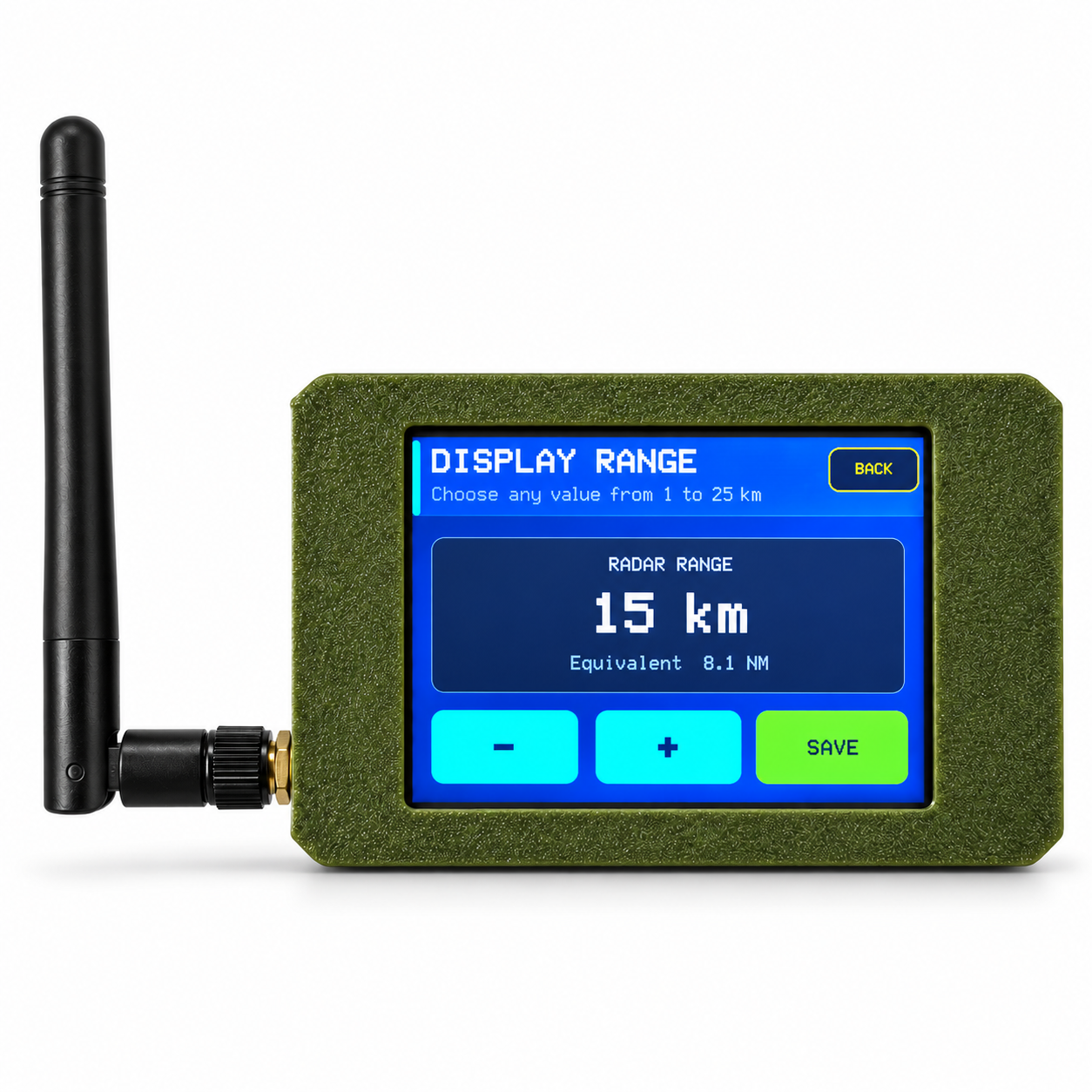
- Adjustable Display Range: Select a custom radar range from 1 to 25 NM or 1 to 25 km.
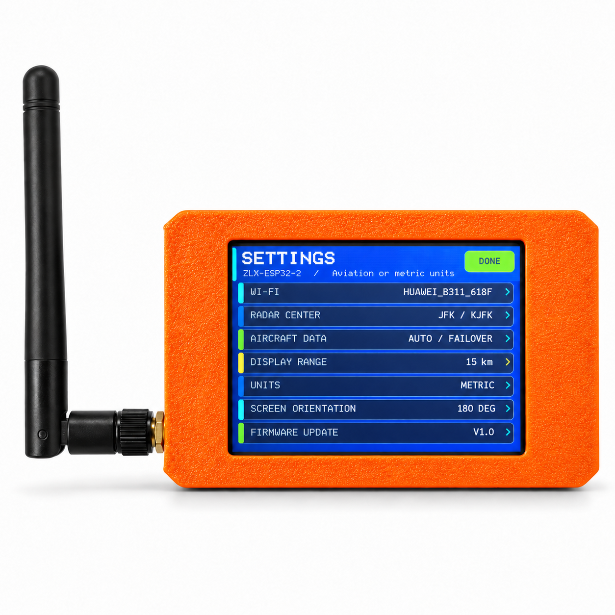
- Aviation / Metric Units: Switch between NM, ft, kt, fpm and km, m, km/h, m/s.
- 180° Screen Rotation: The screen and touchscreen controls rotate together.
- Aircraft Display Limit: Select the maximum number of aircraft displayed on the radar.
4. Quick Start
- Connect the supplied USB cable to the device and a suitable USB power source.
- Wait for the device to start.
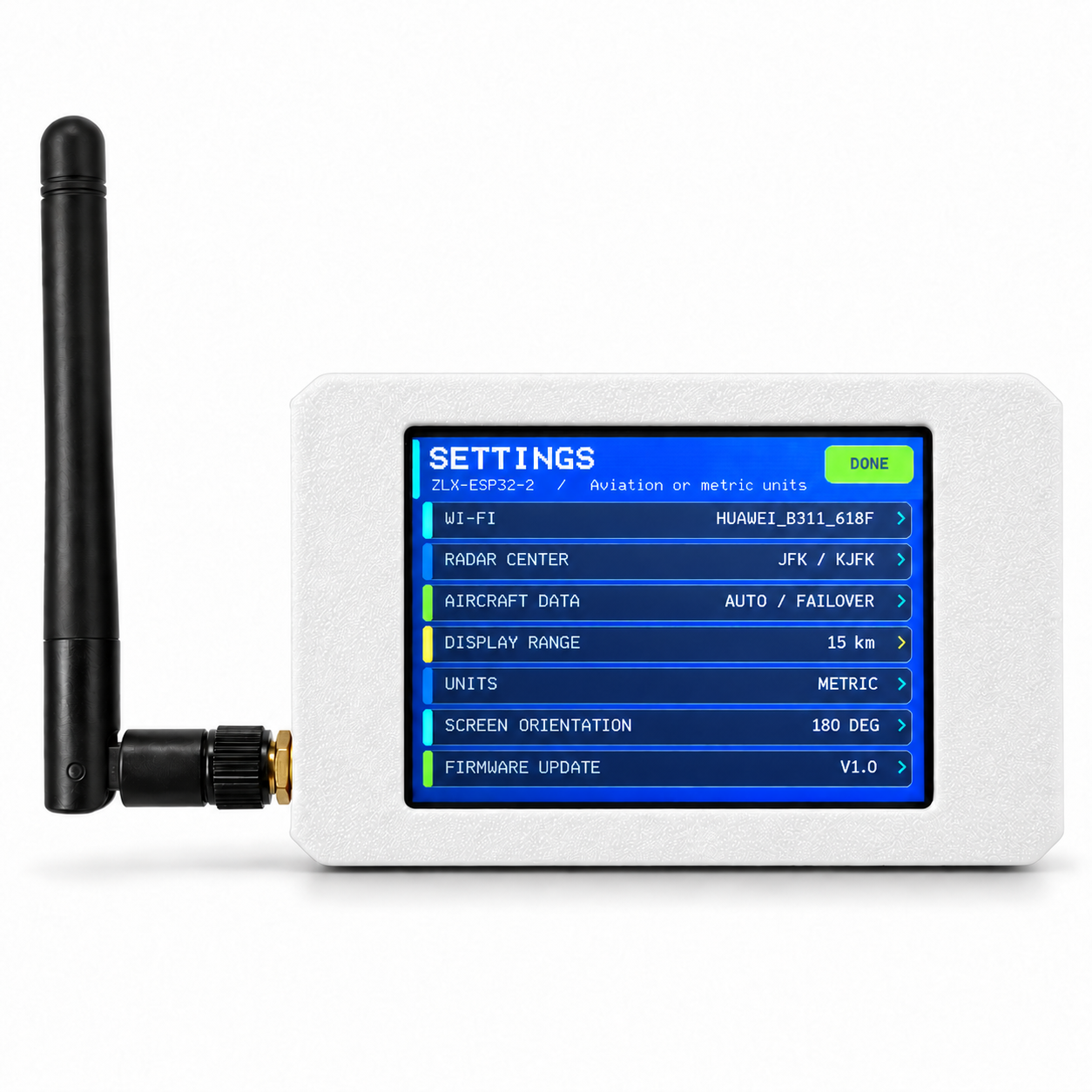
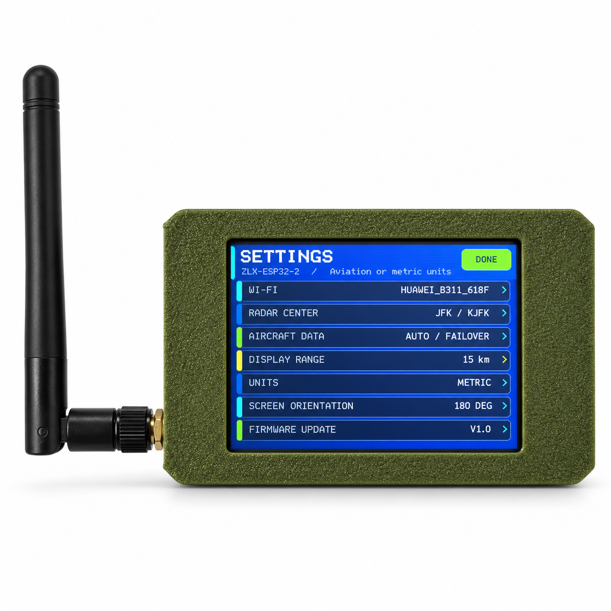
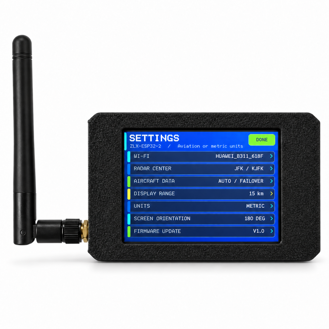
- Open SETTINGS on the touchscreen.
- Open WI-FI, scan for a network, select your Wi-Fi network and enter the password.
- Use SHOW / HIDE to verify the Wi-Fi password if needed.
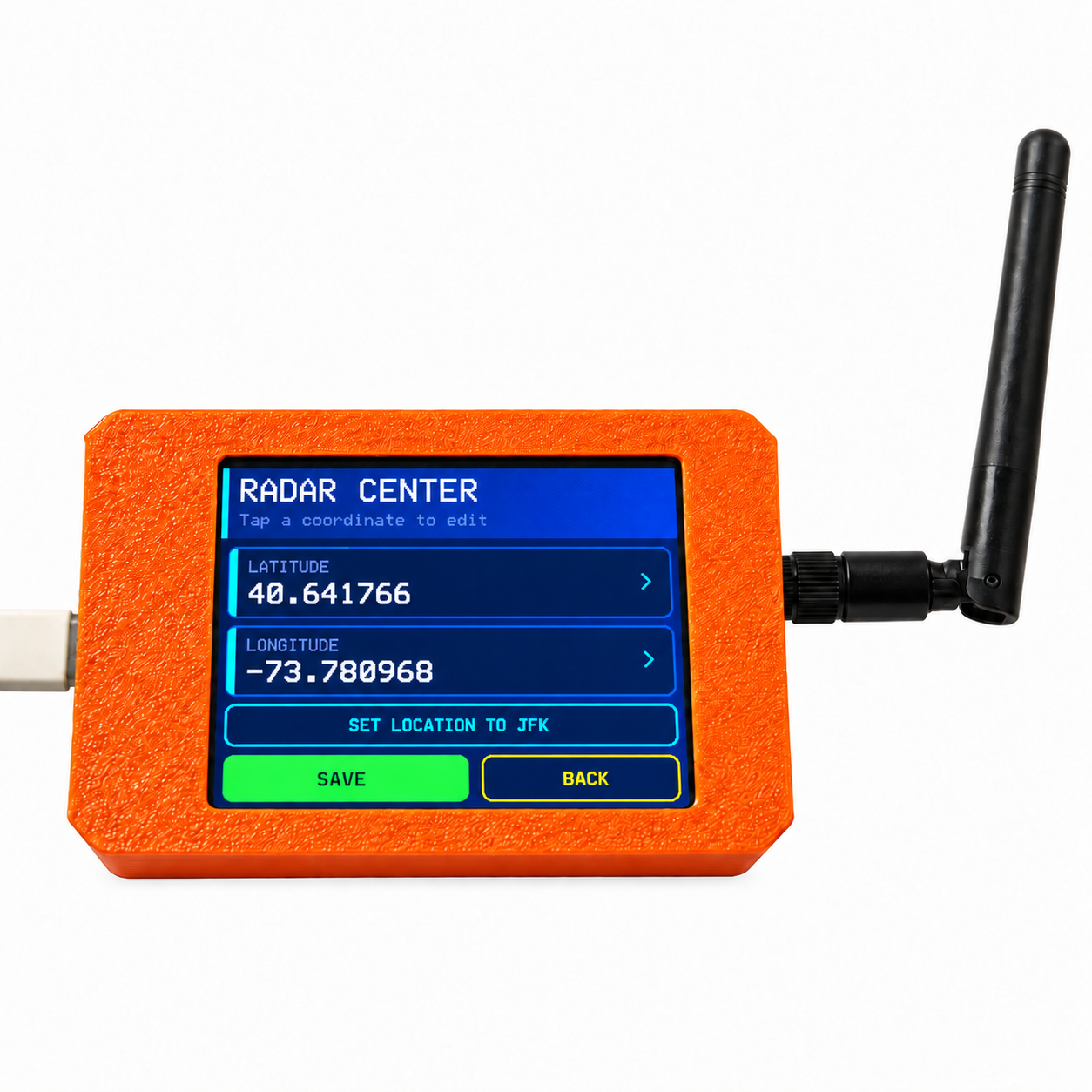
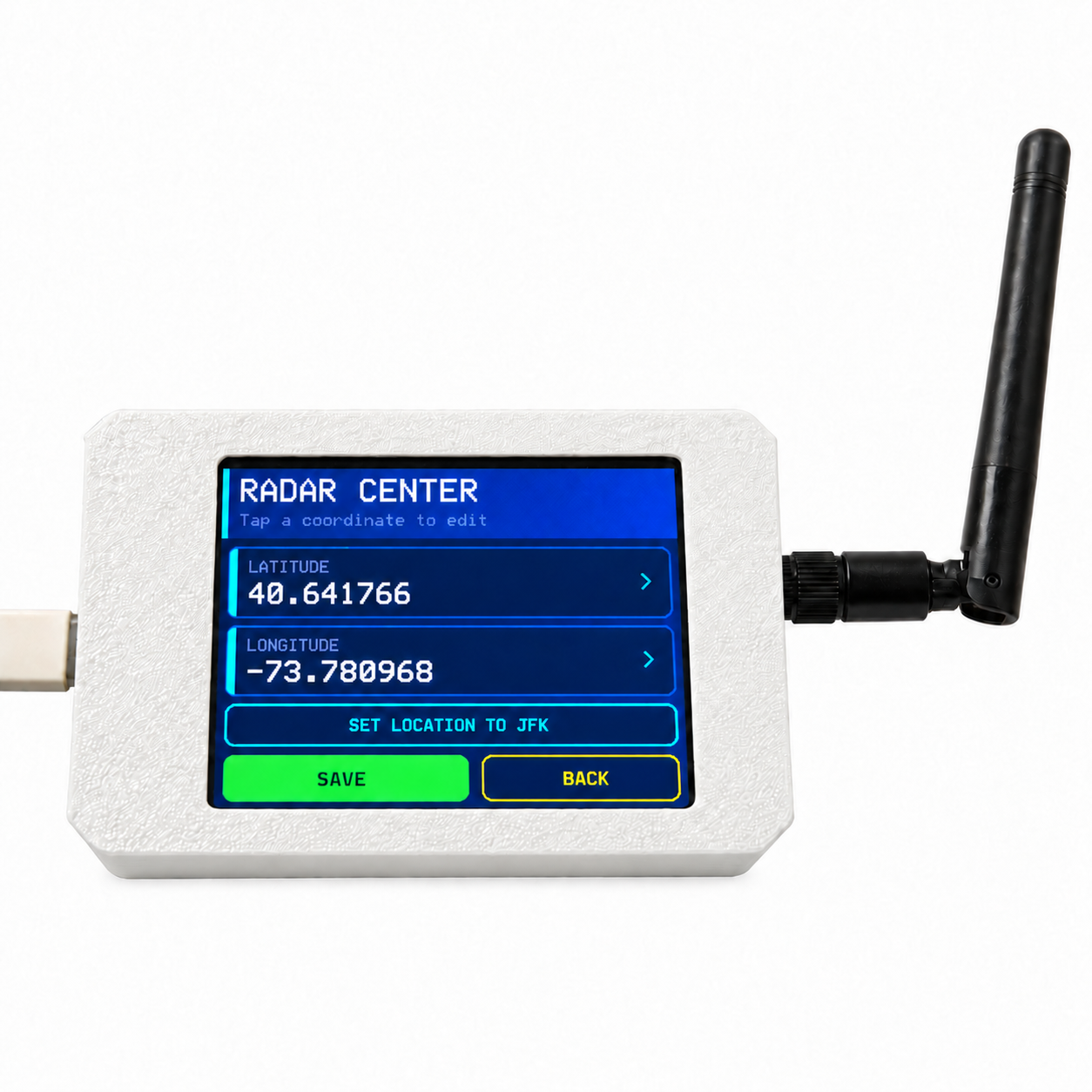
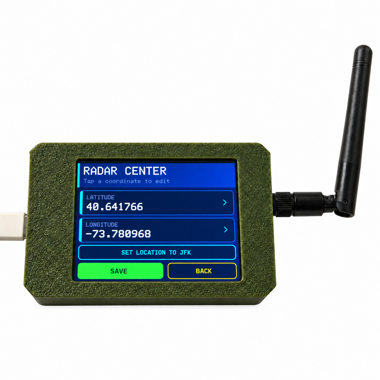
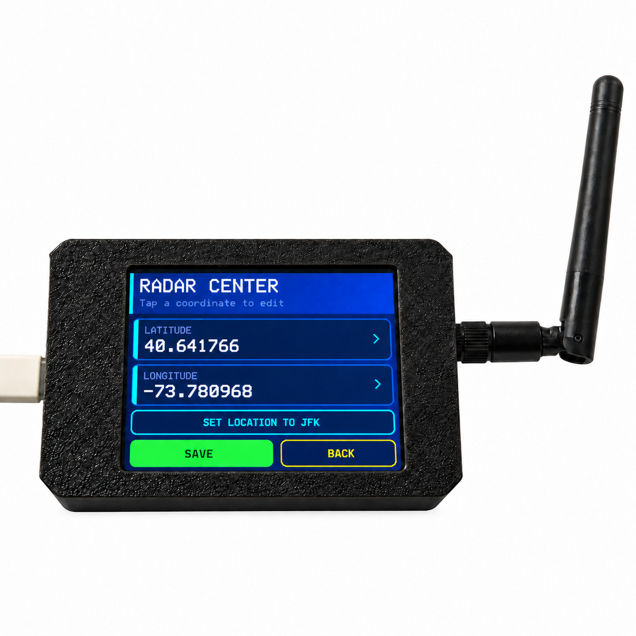
- Open RADAR CENTER and enter the latitude and longitude for the location you want to monitor.
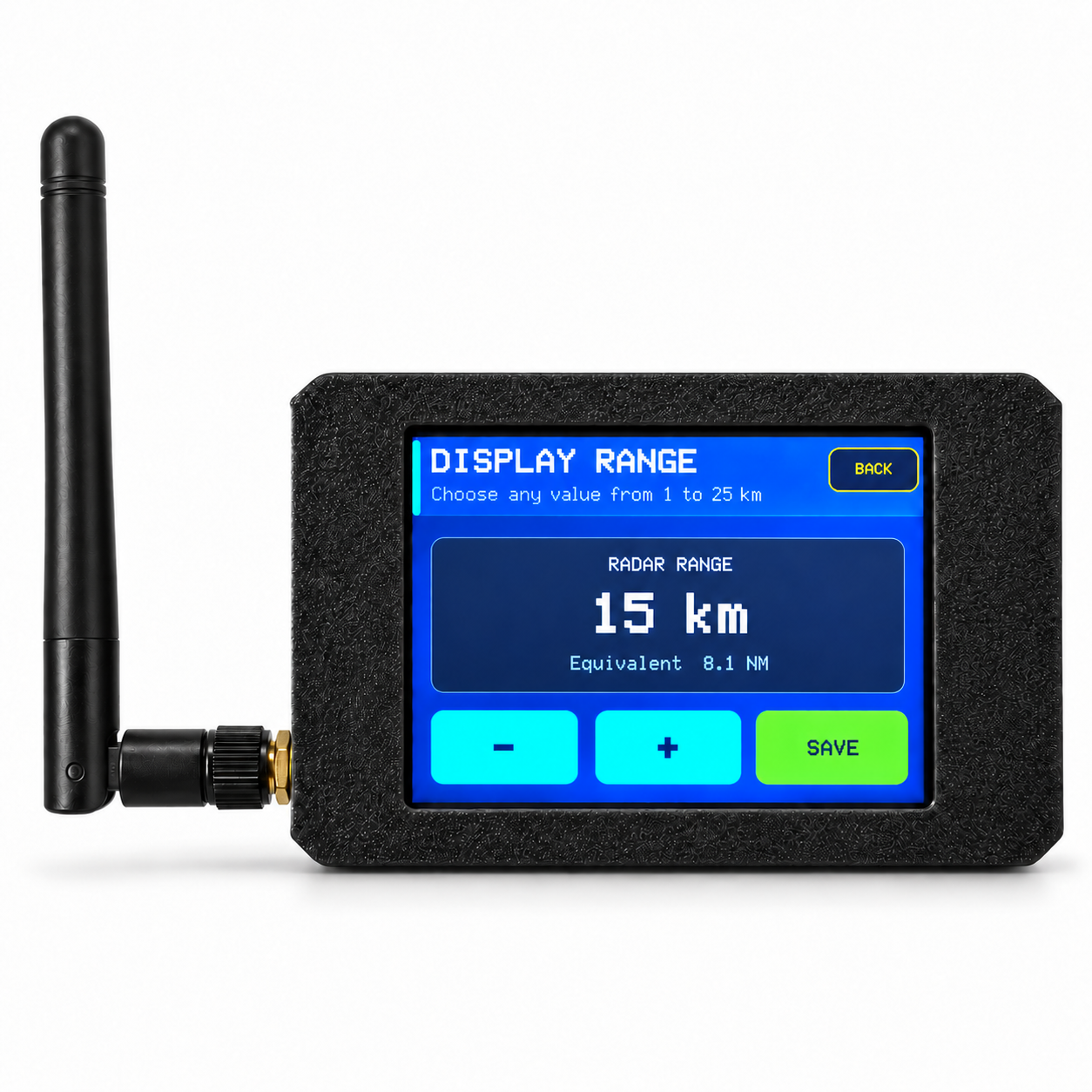
- Open DISPLAY RANGE and select the desired radar range.
- Return to the radar screen. Nearby aircraft will appear after aircraft data is received.
5. Wi-Fi Setup
- Tap SETTINGS.
- Tap WI-FI.
- Start a network scan.
- Select the desired Wi-Fi network.
- Enter the Wi-Fi password.
- Tap SHOW if you want to check the password characters.
- Confirm and wait for the connection to complete.
Standard password-protected home Wi-Fi and mobile hotspot networks are recommended. Networks requiring a web login page or enterprise authentication may not be supported.
6. Set the Radar Center
The radar center is the geographic point used to calculate aircraft distance and position on the radar screen.
- Open SETTINGS → RADAR CENTER.
- Enter the latitude.
- Enter the longitude.
- Save the settings.
Factory Default Location:
John F. Kennedy International Airport (JFK / KJFK)
Latitude: 40.641766
Longitude: -73.780968
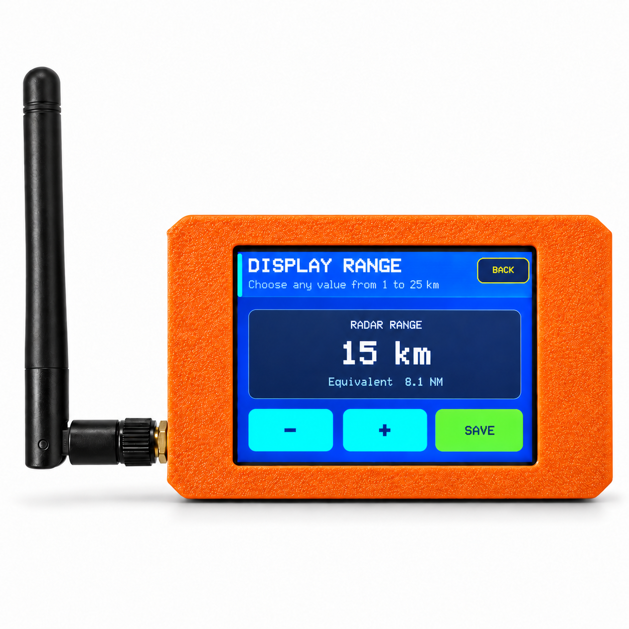
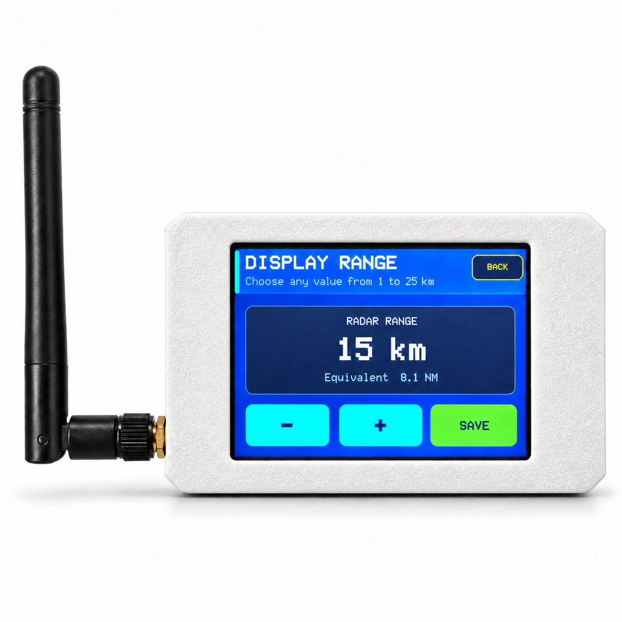
7. Display Range
The radar display range can be adjusted directly from the touchscreen.
Aviation Mode: 1-25 NM
Metric Mode: 1-25 km
Use the - and + controls to change the range, then save. A smaller range shows a closer local area and a larger range shows a wider area.
8. Aviation and Metric Units
Open SETTINGS → UNITS to select the preferred unit system.
Aviation: Distance NM · Altitude ft · Ground Speed kt · Vertical Speed fpm
Metric: Distance km · Altitude m · Ground Speed km/h · Vertical Speed m/s
9. Aircraft Display Limit
In busy areas, many aircraft may be available at the same time. Use the MAX control on the radar screen to limit how many aircraft are drawn.
Available limits: 8 / 16 / 24 / 32 / 48 / 64
This setting controls how many aircraft are shown on the screen. It does not necessarily limit how many aircraft are received from the online data service.
10. Aircraft Details
Tap an aircraft symbol to view available aircraft information, which may include callsign, aircraft type, altitude, ground speed, heading / track, distance from radar center and vertical speed.
To return to the normal traffic / LAST view, tap the X button, tap the selected aircraft again, or tap an empty area of the radar display.
11. LAST Indicator
LAST shows how long it has been since the most recent successful aircraft-data update. For example, LAST 4s means the last successful update was approximately four seconds ago. After a new successful update, the counter returns to zero.
If LAST continues increasing for an unusually long time, check the Wi-Fi connection. A temporary online aircraft data service interruption can also cause delays.
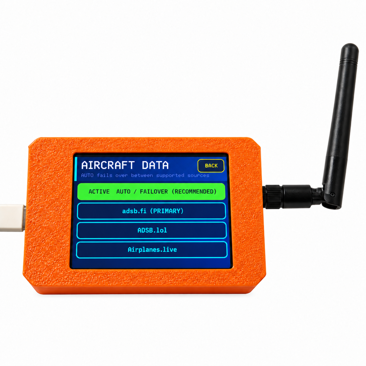
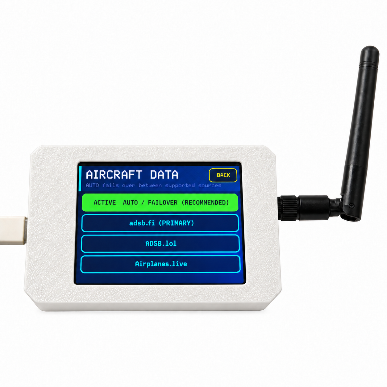
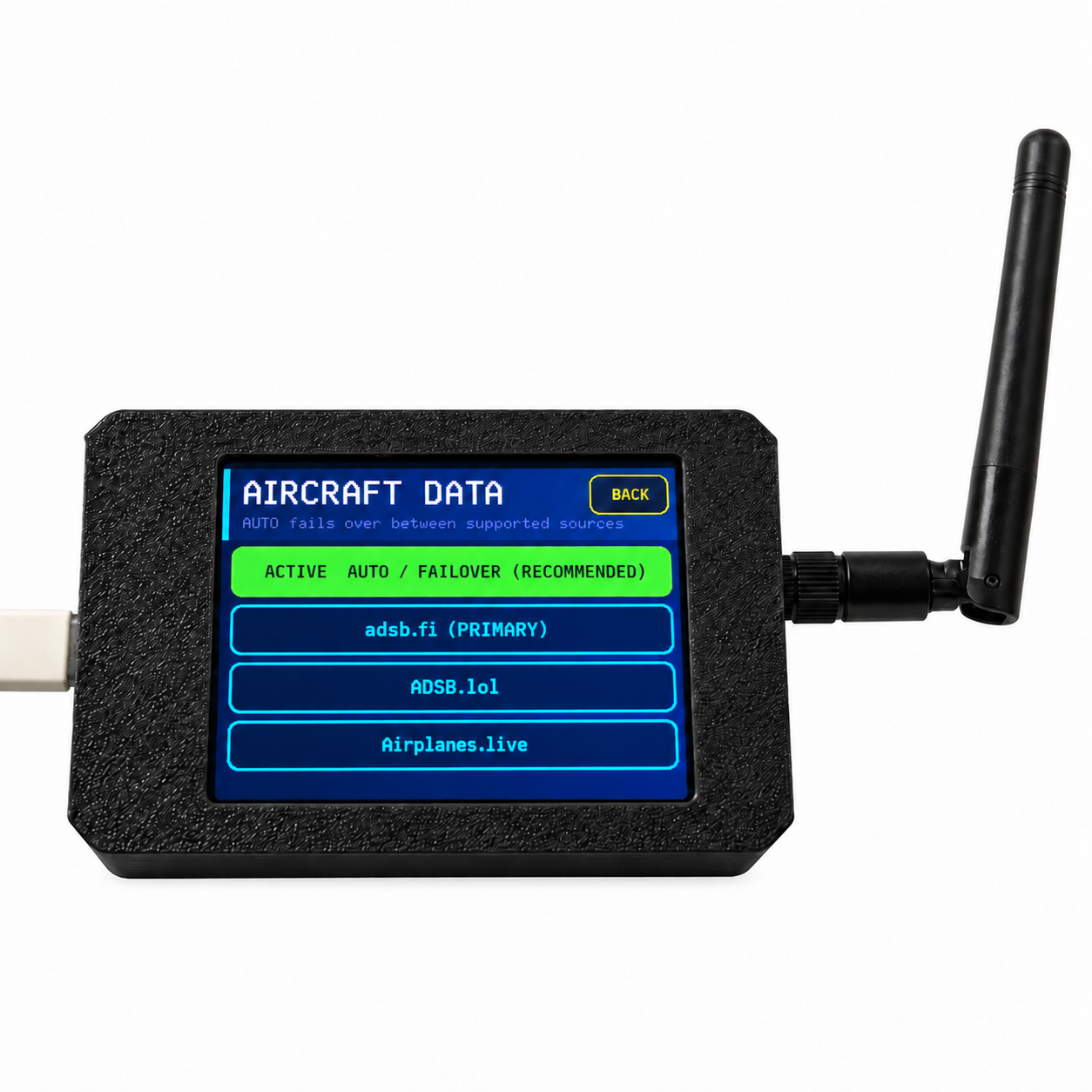
12. Aircraft Data Sources
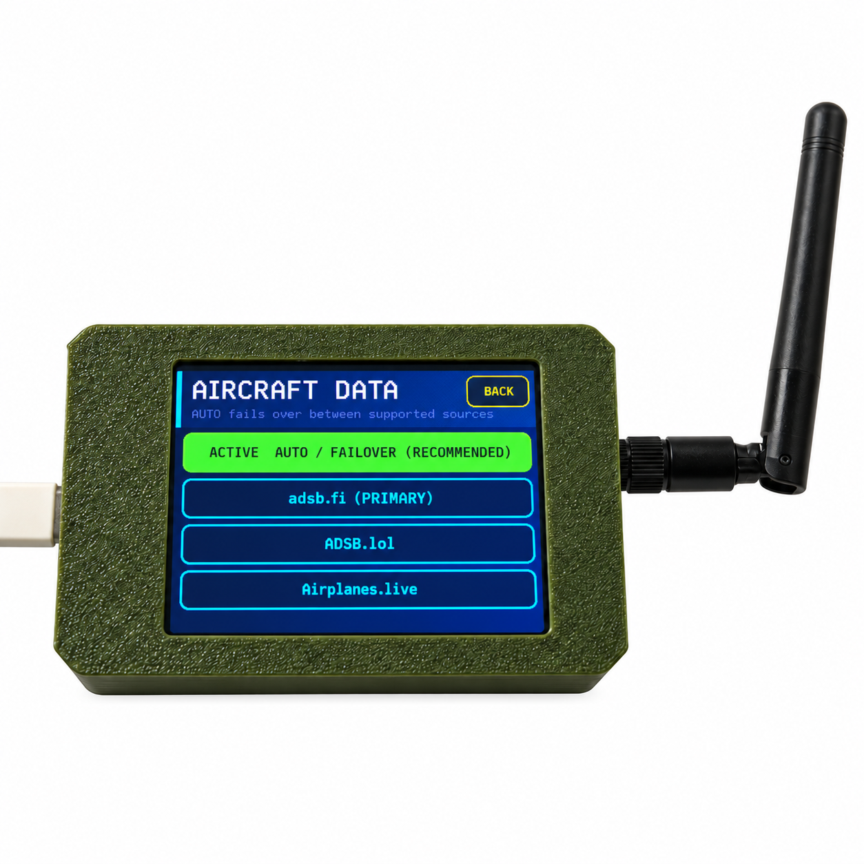
The device supports multiple online aircraft data sources. In AUTO mode, the firmware can attempt another supported source if the current source is temporarily unavailable.
Aircraft availability and update frequency may vary depending on country, region, internet connection and third-party data service status.
13. Screen Rotation
Open SETTINGS → SCREEN ORIENTATION and select NORMAL or 180 DEG. The display and touchscreen coordinates rotate together. The selected orientation is saved after restart.
14. Firmware Information
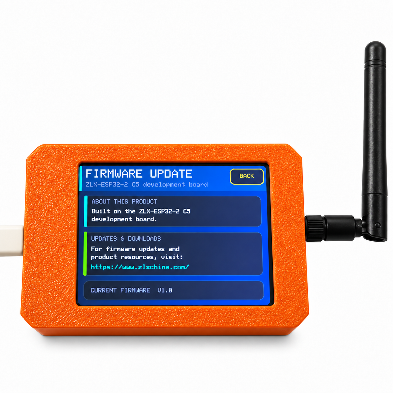
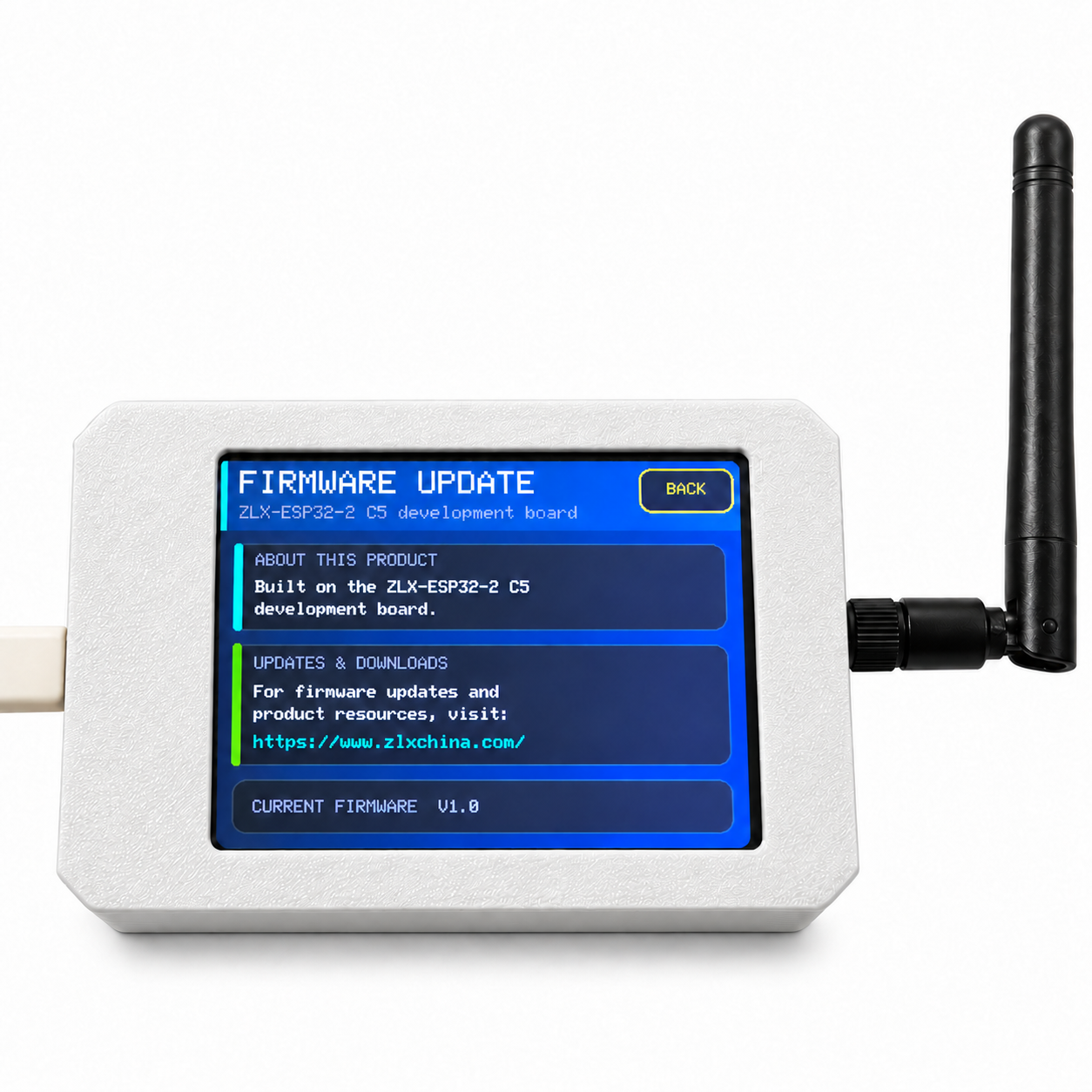
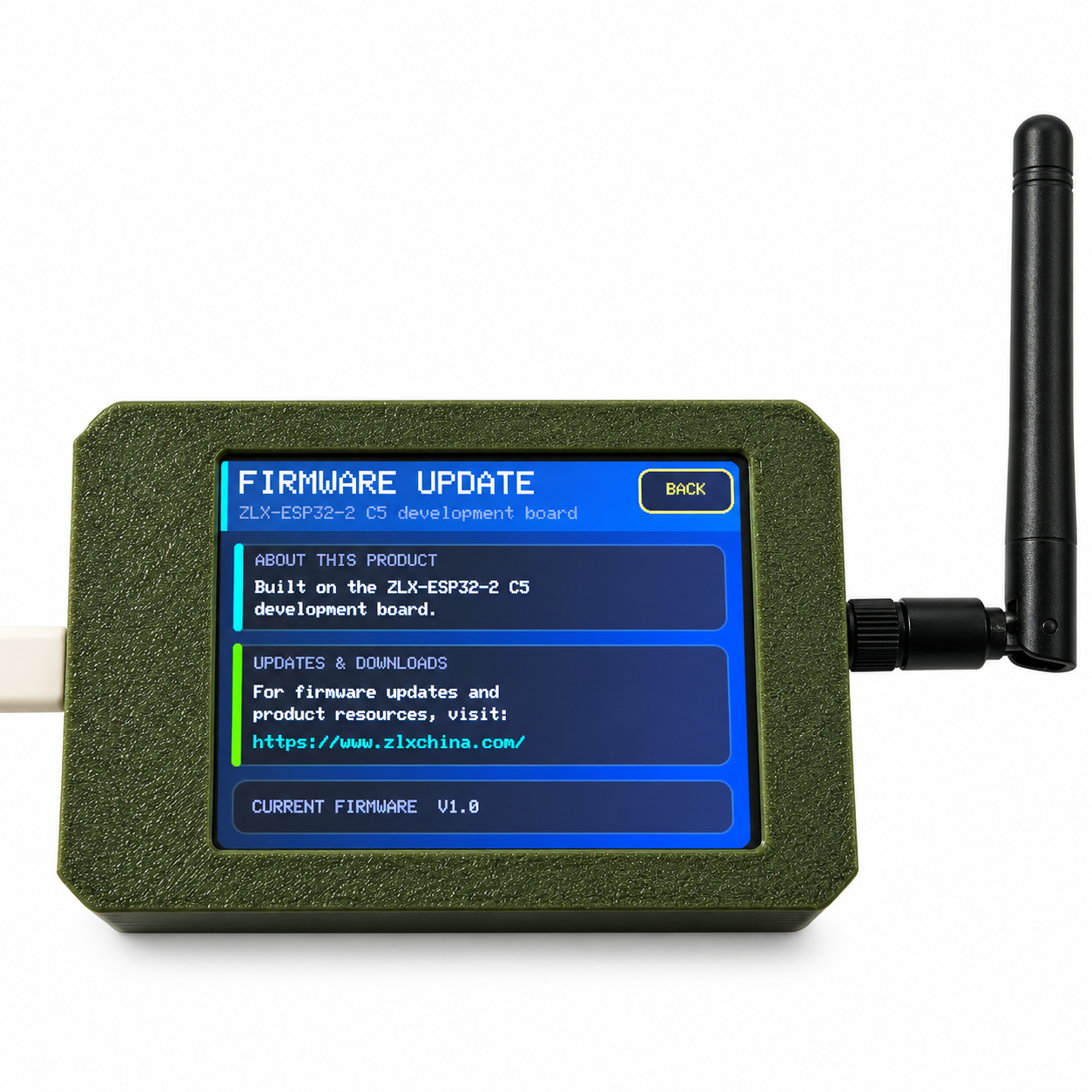
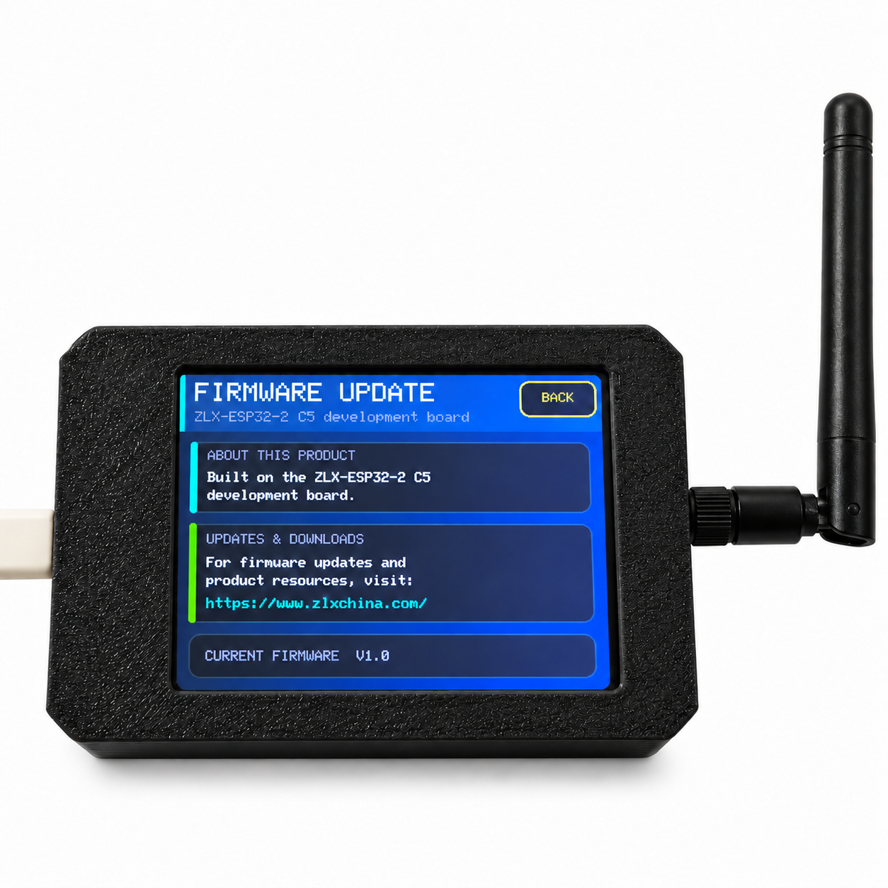
Open SETTINGS → FIRMWARE UPDATE to view the current firmware information and update instructions.
Current Firmware: V1.0
15. Power and Daily Use
- Power the device through the USB Type-C connection.
- Use a stable USB power source.
- Keep the device dry.
- Do not apply excessive force to the resistive touchscreen.
- Use the supplied stylus for more precise touchscreen input when needed.
16. Troubleshooting
No aircraft displayed: Check Wi-Fi, radar-center coordinates, radar range and aircraft data source.
LAST keeps increasing: Check internet access. The selected aircraft data service may be temporarily unavailable.
Wi-Fi password fails: Use SHOW to verify the password and then reconnect.
Too many aircraft on screen: Reduce the MAX aircraft display limit or select a smaller radar range.
Touch direction is incorrect: Open SCREEN ORIENTATION and select the correct orientation.
Aircraft information is incomplete: Not all aircraft records contain every field. Available details depend on the online data source.
17. Important Information
Please Note: This product uses Wi-Fi and supported online aircraft data services to display nearby flight information.
Aircraft availability, displayed information and update frequency may vary depending on the selected data source, internet connection and regional data coverage.
18. Technical Summary
Product: Plane Radar
Platform: C5 Development Board
Display: 2.8-inch Color Touchscreen
Wi-Fi: 2.4 GHz / 5 GHz Dual-Band
Power: USB Type-C
Radar Center: Manual Latitude / Longitude Input
Range: 1-25 NM or 1-25 km
Orientation: Normal / 180°
Interface Language: English
Firmware: V1.0
Unauthorized copying, reproduction, redistribution, modification, firmware duplication, or commercial resale of this manual, firmware, design, or related materials is strictly prohibited.
Specifications and interface details may be updated as firmware evolves.